
A brief introduction
What is it?
We capture aerial photography when and where you want it. We can do it as a one-off or on a regular basis.
What does it do?
When we capture aerial photography for you, it gives you an up-to-date view of a particular location that you can then use in your day-to-day business.
How does it compare to other Aerial Survey providers?
It's generally more expensive than off-the-shelf data, but because we don't have a national capture programme to worry about, we just fly the sites you need. This means that from the point of order, we can get the data delivered to you very quickly and you have very up-to-date information.
What makes it unique?
We use technology which allows us to fly lower, giving us more opportunity to capture data (because we're usually under the cloud).
How much is it?
It depends on the size of the area and what data is needed, but it'll be in the region of £500 per square kilometre. A typical minimum price is £2,500 which covers the survey, processing and delivery.
Use Cases
Commissioning aerial survey products has a wide range of benefits:
Protecting your staff against making decisions on old data
We provide a range of map datasets through XMAP Cloud GIS and XMAP Feeds, but off-the-shelf data might not be updated as much as you'd like.
To protect against staff making decisions on outdated data, a cost-effective XCAM survey can be a great solution.
Detecting change
National flying programmes come around every 3-5 years, but your project might need a monthly or even weekly updated view.
We can fly at the frequency and resolution for the project.
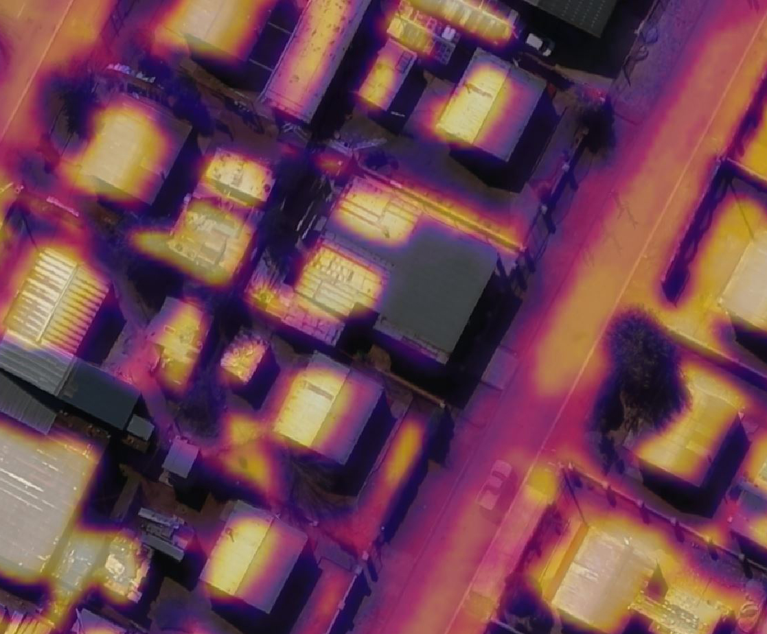
Finding heat loss from buildings, pipelines and the environment
A thermal survey can give you an indication of where energy is being wasted.
It can also be used to detect heat sources that you weren't aware of. Pipeline leaks and underground heat source detection can help reduce energy waste.
Where you need a different perspective
Sometimes it's important to know the fine detail about a site or property. For example, how many floors does it have, and what materials are used?
Commissioning an oblique or 3D survey can give you this high-resolution birds-eye view.
Analysing vegetation growth and condition
Commissioning an NDVI survey gives you a unique perspective of the health and type of the vegetation (with a bit of analysis).
We can process the data for you, or give you the raw data to run through your own algorithms.
Producing detailed elevation models for slope analysis
Whether it's for coastal monitoring or cycle lane analysis, an elevation model has a wide range of uses.
If there's anything in particular you're looking for in the data, we can provide processing services to help you.
Available Survey Types
Our survey services include the planning, capture, processing and delivery of the data. We use semi-automated processes to get the data to you as fast as possible. We deliver the data on a Hard Drive or through our XMAP services.
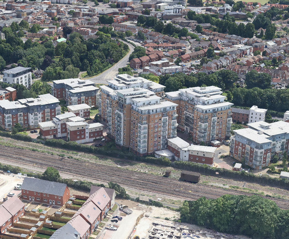
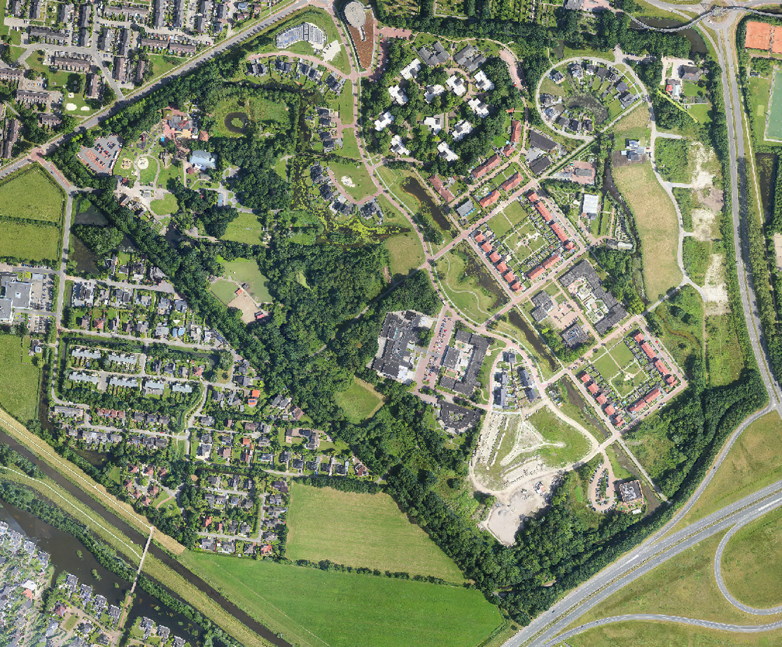
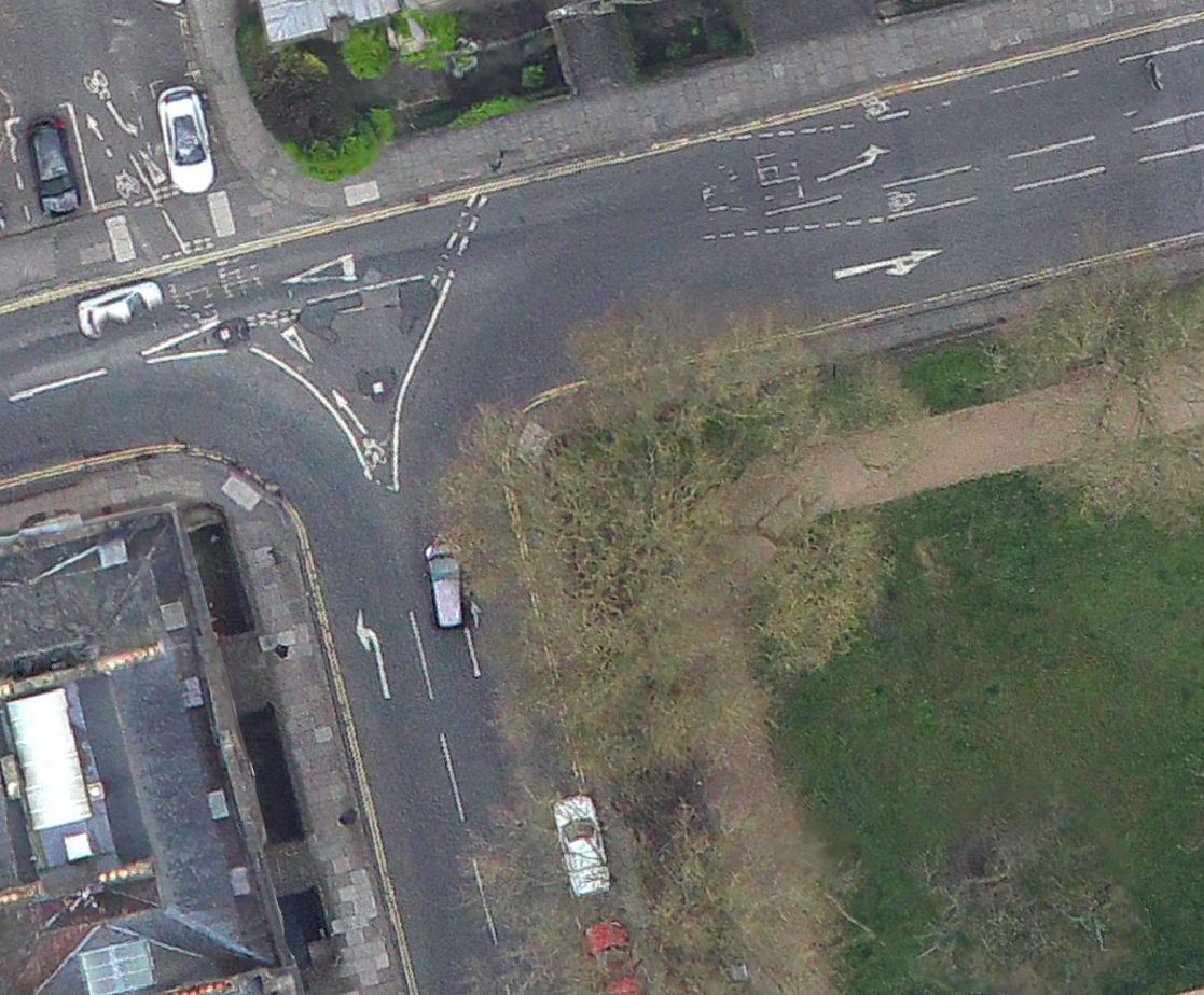
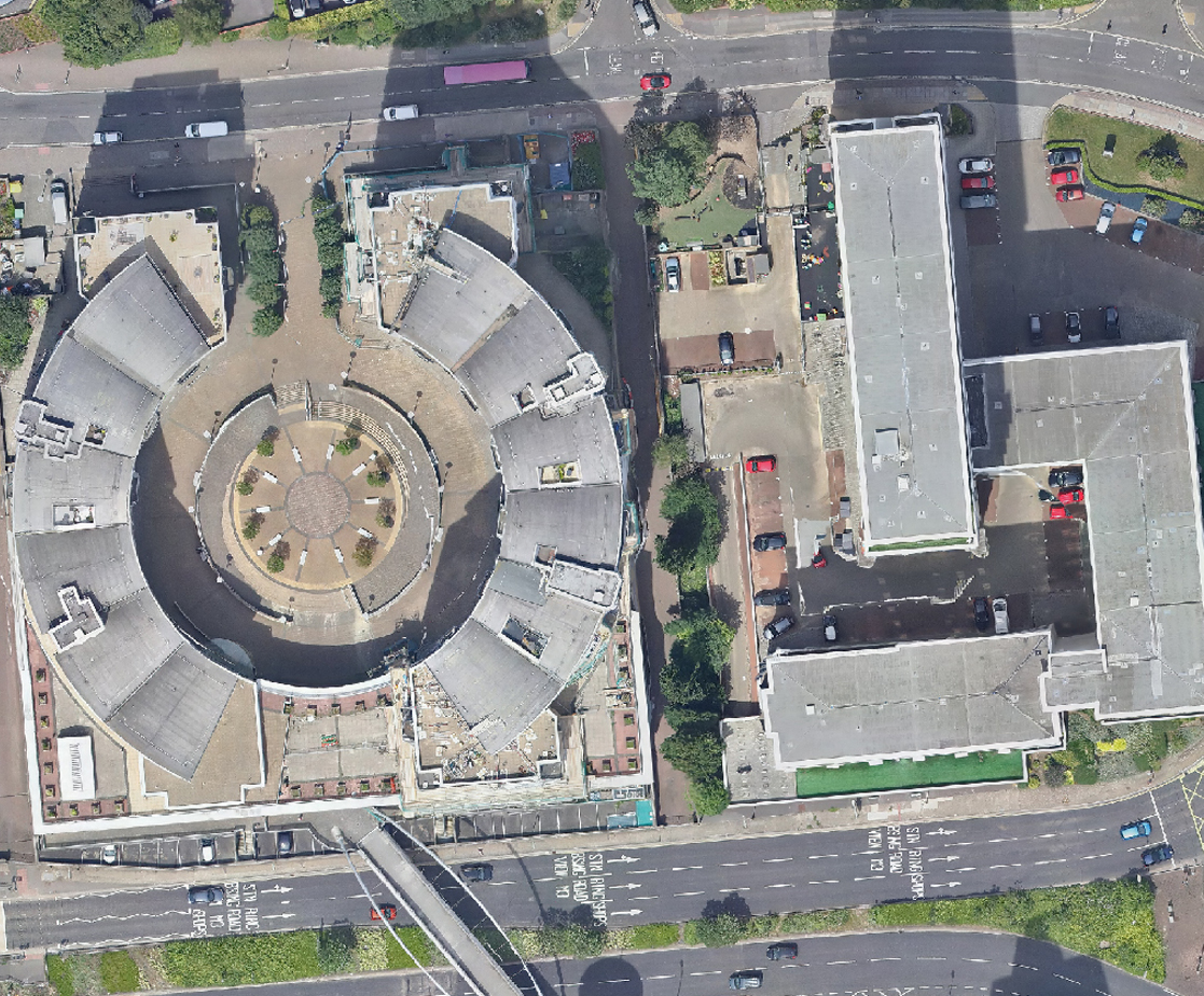
Vertical Aerial Imagery
We capture overlapping images of the ground to produce a top-down aerial photograph. We process the dataset so that it is colour-balanced and has as little building-lean as possible. This allows for accurate digitising from the dataset.
Resolution: 3cm - 20cm GSD
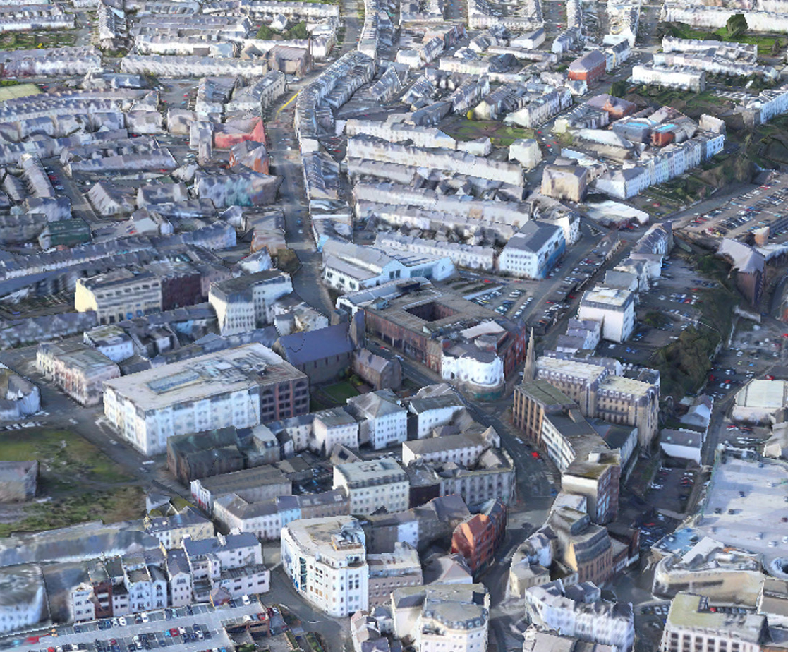
Oblique Aerial Imagery
We capture overlapping imagery, typically at 45 degrees from vertical. This produces photography where the sides of buildings and features can be seen. Every point in the survey area will be covered by at minimum a North, South, East and West view.
Resolution: 4cm - 15cm GSD
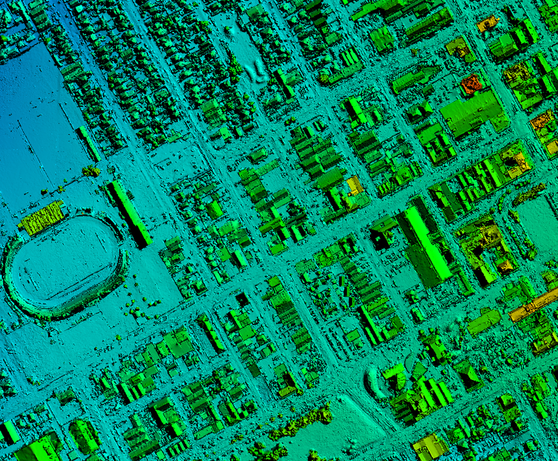
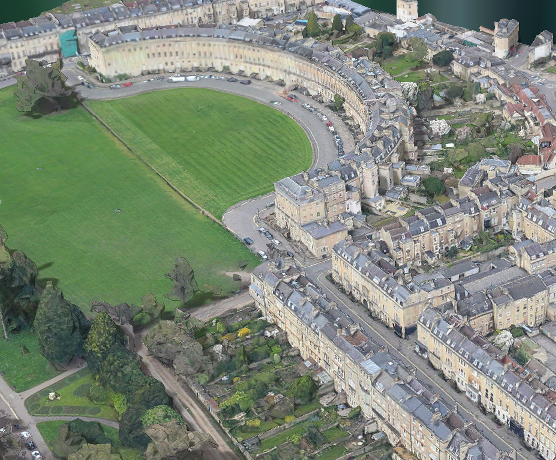
3D Model
To produce a 3D mesh model we actually conduct an Oblique survey. We then use this oblique data to render a photorealistic 3D scene. Using 3D viewers it's possible to view and analyse the data from any angle. Typically 3D uses include viewshed analysis, line-of-sight, volume calculations and shadow analysis.
Resolution: as per an oblique aerial survey
NDVI
We capture both true-colour aerial photography and colour near-infrared photography to produce a Normalised Density Vegetation Index (NDVI). This map gives values from -1 to 1 of chlorophyll response from vegetation. This can be used to identify species or vegetation health.
Resolution: as per vertical aerial survey
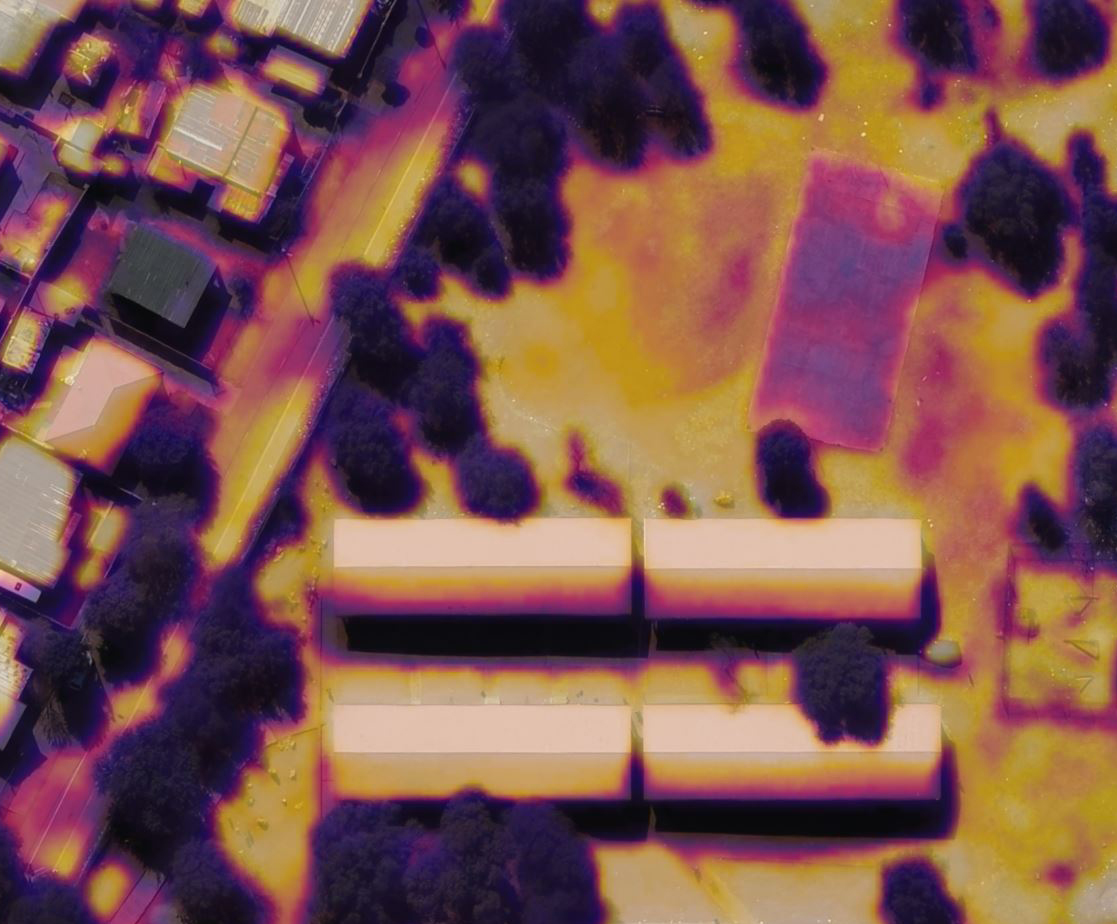
Thermal
Thermal surveys are normally conducted at night during the winter to give the best results. A thermal survey map shows heat intensity from the ground. This can highlight areas of heat loss such as leaks, innefficient buildings and underground heat sources.
Resolution: 56cm - 120cm GSD
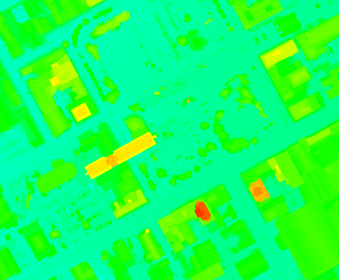
Elevation
We can produce an elevation model as a derived product from a vertical aerial survey. The results are a detailed map of surface feature heights, such as buildings. This can be used for measuring buildings, importing into flood models or generating contours.
Resolution: as per vertical or oblique aerial survey