About Us
Democratising geospatial data through innovative cloud services
Our Purpose
As a team we’ve been building mapping and data tools since 2008. In 2016 we became Geoxphere and took full ownership of our products and customers.
The founding idea was straightforward: GIS is powerful, but the complexity of the data and systems had always limited it to large organisations with specialist staff. We set out to change that – building cloud platforms that put professional mapping tools in the hands of organisations that previously had no realistic route to them.
Parish Online, our first Cloud GIS, launched in 2008, has brought that vision to over 2,500 town, parish and community councils across England, Wales and Scotland. XMAP extended it to district, borough and unitary authorities, central government bodies and a range of commercial sectors.
The common thread is the same: powerful geospatial capability, made genuinely usable by non-experts.
Our Approach
We believe in breaking down the barriers to using GIS data and tools. It should be available for any organisation with any skill level.
When you subscribe to one of our services, you’re not just getting the service, you’re getting our entire team. We maintain close relationships with our subscribers to make sure they have the best service possible.
Our Team
-

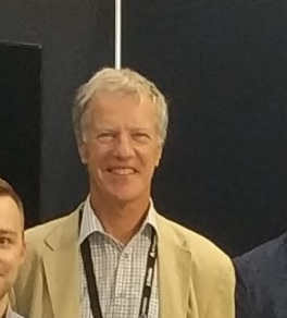
Chris Mewse
Managing Director
-

Tom Huntley
Technical Director
-
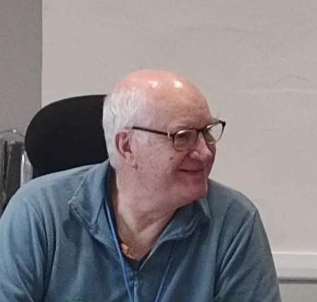
Tristram Cary
Director & Chairman
-
Chris Wooding
Database Specialist
-

Jack Towns
Software Developer
-

Simon Miles
Geospatial Specialist
-

Chris Ryan
Geospatial Data Engineer
-
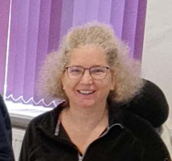
Wendy Bates
Parish Support Specialist
-

Andrew Skellern
Parish Support Specialist
-

Vicki Mewse
Marketing & Events Coordinator
-

Will Moore
Parish Technical Support
-

Sarah Thum-Bonnano
Wellbeing Coach
Our History
Our team first started working together in 2007 when we created Parish Online, a tool for helping local councils access digital mapping data. It was primarily a viewer for Public Sector Geospatial Agreement (PSGA, then PSMA) data. Over the years it grew in capability and breadth which gave us a strong foundation providing SaaS.
We then expanded the capabilities to turn it into a corporate GIS system for District, County and Unitary Authorities. This was the at the bleeding edge of cloud computing at the time but our approach meant it was a powerful and scalable service. This was eventually called XMAP and is still leading the way in cost-effective geospatial cloud computing.
In 2016 we changed from being a department within a company, to spinning off to become our own entity. This began as Geoxphere LLP and latterly, in 2018, Geoxphere Ltd.
The new company allowed us to forge our own path and accelerate our development of our services using the latest in cloud server technology and web-based tools. Along the way we developed bespoke geospatial applications for large organisations as well as our core cloud GIS products.
In the early days of Geoxphere we also embarked on providing ground and aerial survey services. We were using pioneering small wing-mounted camera to capture ultra-high resolution photorealistic 3D models. This data fed into XMAP to give customers detailed mapping not readily available at the cost and frequency we could offer. However, around 2020 we scaled back this operation to focus on SaaS, helping UK Local Government make the rapid and unplanned switch to cloud GIS due to the Covid pandemic.
Being a key supplier of mapping to town, parish and community councils led us into offering a wider array of digital services. In 2022 we launched a website, email and cloud storage service, fine-tuned to the local council sector and utilising the latest GOV.UK Frontend framework, and exclusively using GOV.UK domain names. We’re proud that were, and still are, at the forefront of helping the local council sector transition to modern, secure and authoritative digital services.
Aligned to the mission of providing services that really make a difference, in 2023 we created a sister company, Local Authority Technology Community Interest Company (CIC). This would be our not-for-profit social enterprise to ensure our products provided high social value and reinvested revenue back into the services. This has been used to support struggling councils, invest in regional member events, and keep subscription costs low, even against the economic climate of high inflation.
To the present day we’re still pushing the boundaries of what’s capable with cloud geospatial services. Our focus has turned towards utilising the vast databases of geodata at our disposal and processing it and presenting it in intuitive and insightful ways. We’ve adopted the use of AI to enhance our offering through rapid development, greater data processing capability and producing new and innovative tools.
We are also at the vanguard of delivering Ordnance Survey‘s switch to their National Geographic Database (NGD), bringing tens of thousands of nightly updates of data into our Cloud GIS and displaying them in unique ways. This is key for UK Local Government, especially with Local Government Reorganisation and the opportunity for bringing GIS systems into the 21st century (it’s about time!).
We thoroughly enjoy supporting our customers to do amazing things with geospatial.
Our Environmental and Social Value
We take the principle of providing social value seriously, which is why we created Local Authority Technology CIC to deliver positive change for all tiers of UK Government, and the businesses we work with.
We carefully choose our suppliers to ensure we our services are built on ethical and sustainable foundations. Our environmental impact is high on the agenda with any project we embark upon.